

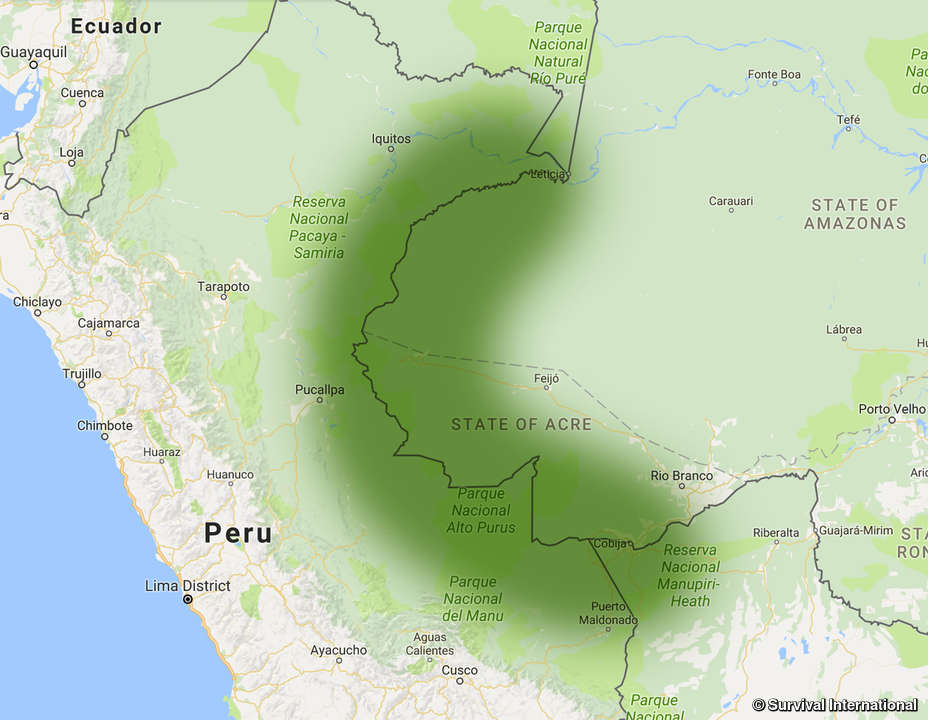
This was surprisingly difficult to find information on. Translated by yours truly: The border line covers the territory between the mouth of the Yavarí river and the mouth of the Yaverija river in Acre (Brasil) and extends entirely en the Amazon Jungle. […] The border was demarcated two treaties: Convención Fluvial sobre Comercio y Navegación entre la República del Perú y el Imperio del Brasil which creates the north border at the beginning of the Yavarí and the Tratado de Límites, Comercio y Navegación de la Cuenca del Amazonas, entre el Perú y Brasil. I couldn’t find an English source for either treaty nor do I really feel like translating five pages lol. I guess it follows the Yavarí for most of the way until it meets the Río Branco? Not sure where it goes from there though
I saw that difficulty and immediately gave up and made an open ended comment. Thank you for doing that research 💪. It’s very interesting
So I said screw it and skimmed the damn thing. Article 7 of the treaty mentions borders, but only serves to clarify that the preexisting borders will continue to exist and that they “be natural and convenient for one and another nations”.
Interestingly, article 5 says that black slaves will not cross the borders, and escaped slaves will be returned to their respective country. Turns out that Brazil did not ban slavery until 1888! Peru never had slaves so I’m not who the Brazilians would need to return
