


reference for the uninitiated like me ☞ https://en.wikipedia.org/wiki/Counties_of_England
This is the one that matches OP’s map:
https://en.m.wikipedia.org/wiki/Ceremonial_counties_of_England
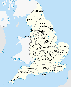
For those wondering why these borders don’t match up: England’s county system is actually the butchered remains of several iterations stitched together in a manner that would appal Dr Frankenstein. This image shows the historic counties, but those basically only exist for cultural reasons today and have not been used for governance since the 70s. They don’t quite match the post - see, for example, Yorkshire being one massive thing in this image but split into four in the post. Even though one of the four is called “east third”. The post’s border also don’t match the modern counties though, so I’m not quite sure what exactly is being shown, but it could be older borders or just whichever borders had the most interesting set of names
